by Shelly C | May 28, 2015 | Flood Zones
An Elevation Certificate (EC) doesn’t have an expiration date per say, but there are some factors that do play a role in determining if an EC is still “good”. Has the FIRM been updated? The Flood Insurance Rate Maps (FIRM) are updated periodically. The updates...
by Shelly C | May 13, 2015 | Uncategorized
Boundary Surveys Q. What is the difference between a “Stake Survey” and a “Boundary Survey”? A. Nothing! “Stake Survey” is a common name for the legal term of “Boundary Survey.” Q. What is a Boundary (stake) survey? A. Survey Services: Boundary Survey Q. What is a...
by Shelly C | May 6, 2015 | Surveying Related
Adverse Posession – Do you know what you own? The first step to take is to have a boundary survey (aka stake survey) performed on your property. By having a boundary performed, property corners will be clearly and visibly marked for all parties to see. If the...
by Shelly C | May 6, 2015 | Flood Zones
An Elevation Certificate (EC) is a form that was developed by FEMA (Federal Emergency Management Agency). Its purpose is to act as the official record to document the elevation of a building. The form must be completed by a professional land surveyor or engineer. Is...
by Shelly C | May 5, 2015 | Flood Zones
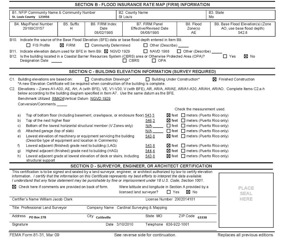
Part 2 An Elevation Certificate (EC) contains a wealth of information regarding a property and its risk of being flooded. The EC is performed by a Professional Land Surveyor or Engineer. This article further discusses the second half of the EC, please refer to the...
by Shelly C | Mar 26, 2015 | Flood Zones
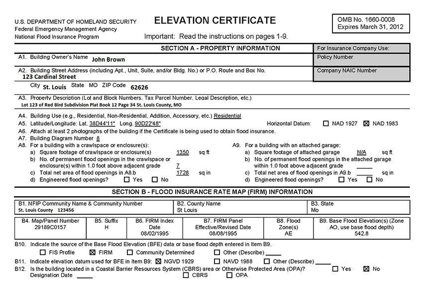
Part 1 An Elevation Certificate (EC) contains a wealth of information regarding a property and its risk of being flooded. The EC is the form provided by the Federal Emergency Management Agency (FEMA) to determine the risk of flooding. The EC consists of 4 pages. Pages...
by Shelly C | Mar 13, 2015 | Flood Zones
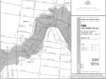
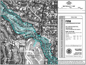
A Flood Insurance Rate Map (FIRM) can be an invaluable asset when looking for information regarding the location of flood zones. These maps depict and show where the water sources in a community are located, along with where it is projected that the water will go in...
by Shelly C | Mar 3, 2015 | Flood Zones
Part 2 FIRM is an acronym for Flood Insurance Rate Map. In Part 1 we discussed Physical Features, Legends and Benchmarks. Next we will explore 3 more areas to be familiar with: Special Flood Hazard Areas (SFHA), Base Flood Elevation (BFE), and Community Information....
by Shelly C | Mar 2, 2015 | Flood Zones
Part 1 of 2 FIRM is an acronym for Flood Insurance Rate Map. A FIRM is used by a multitude of professions who can benefit from the information that the map provides. Those who use FIRMs include professional Land Surveyors, Engineers, Insurance Agents, Community...
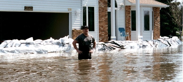
by Shelly C | Dec 30, 2014 | Flood Zones
The purpose of the Elevation Certificate is to determine if a property is in the flood zone or is at risk of flooding. Professional Land Surveyors and Engineers are able to provide the services needed to complete an Elevation Certificate (EC). The cost for these...