by Shelly C | Feb 18, 2016 | Radio & TV
Shelly Clark tells us what the differences are between the survey types and surveyor’s real property reports. SRPR, Boundary Surveys, Easements

by Shelly C | Feb 18, 2016 | Surveying Related
A title commitment is the document that a title insurer prepares which shows all of the liens, defects, burdens and obligations that a piece of property and its buyers and sellers have. A survey company reviews this document and uses several portions of the document...
by Shelly C | Feb 1, 2016 | Surveying Related
A topographical survey shows a 3-D depiction of land on a 2-D product. There are many reasons as to why this information can assist a property owner. Here are a few of the main reasons: To build on. If you have a vacant piece of property, the topographic survey can...
by Shelly C | Dec 9, 2015 | Surveying Related
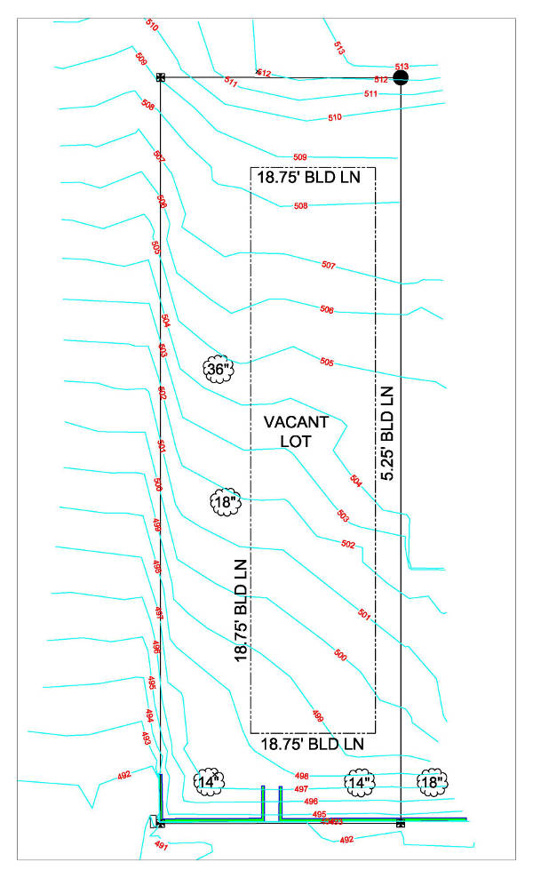
We live in a 3 dimensional world. Yet when a property survey is made, the results are shown via a 2 dimensional product – good ole paper and ink. A Topographical Survey is a 2-D representation of what is happening in the real world (3-D). The characteristics of...
by Shelly C | Oct 15, 2015 | Surveying Related
The purpose of a boundary survey is to mark and identify where your property corners are located. Simply put, it shows you where your property begins and ends. When a boundary survey is completed by a professional land surveyor, a drawing is generated to show the...
by Shelly C | Oct 15, 2015 | Surveying Related
We live in a perfect world, where no one makes mistakes… right? People don’t build houses or garages on the wrong lot, and always build the fence on their own property. If that were the case, professional land surveyors and attorneys wouldn’t be needed near as much....
by Shelly C | Sep 17, 2015 | Surveying Related
See Also: Boundary Survey Process and Considerations The property boundary survey and “stake” survey are one and the same. The term “boundary” is the legal term to identify that the boundaries of a property will be marked by locating the property corners. The term...
by Shelly C | Aug 6, 2015 | Flood Zones
FLood Insurance is offered through the National Flood Insurance Program (NFIP), which is administered by the Federal Emergency Management Agency (FEMA). This federal program offers flood insurance, which can be purchased from more than 80 private insurance companies....
by Shelly C | Jul 14, 2015 | Flood Zones
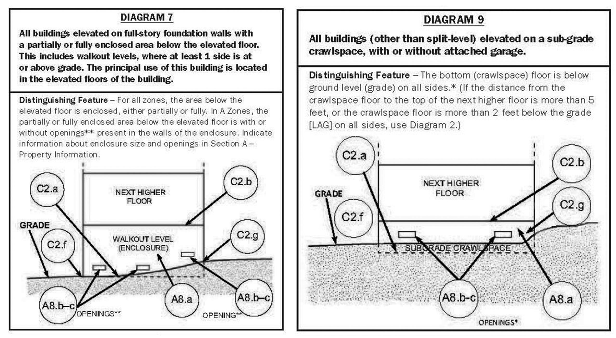
When a licensed Professional Land Surveyor or Engineer are hired to perform an Elevation Certificate (EC), they are providing data which will determine if the structure located on the lot is at risk of flooding. If the EC results are favorable and the structure is...
by Shelly C | Jun 29, 2015 | Flood Zones
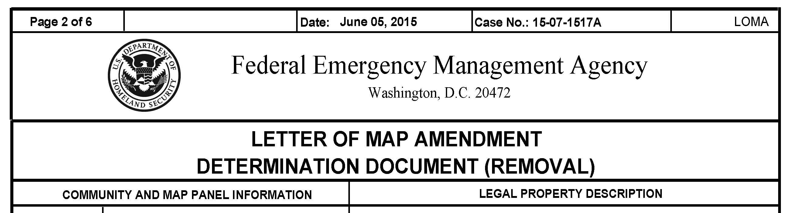
FEMA, NFIP, FIRM, EC, BFE, LOMC, LOMA Explained The Federal Emergency Management Agency (FEMA), is managed by the National Flood Insurance Agency (NFIP) and uses Flood Insurance Rate Maps (FIRMs) to determine if properties are at risk of flooding. What happens when...