Get a free quote

636.922.1001

inbox@cardinalsurveying.com

  • Surveys
    • Boundary Survey
    • Alta ACSM Surveys
    • Surveyor’s Real Property Report
    • Topographic Surveying
    • Plot Plans
  • Elevation Certificates
    • Flood Insurance and Elevation Certificates
    • FEMA / FIRM
  • Blog
    • Surveying Related
    • Flood Zones
    • Commercial
  • F.A.Q
  • About us
  • Videos
What is the use of land surveying?

What is the use of land surveying?

by Shelly C | Mar 13, 2023 | Land Surveying, Surveying Related

There are several purposes for having a land survey performed on your property. Here are a few of the different types of surveys and what their use is: Boundary survey. The purpose of this survey is to determine the location of a property. You frequently have a...
ALTA Survey Table A items Part 1

ALTA Survey Table A items Part 1

by Shelly C | Feb 14, 2023 | ALTA Survey, Commercial, Surveying Related

One of the unique characteristics of an ALTA survey is the flexibility that it provides for the client. Because this is a much more intensive look at a property, there are many additional items that can be addressed by the survey. The Table A provides a list of 19...
How can we determine property lines?

How can we determine property lines?

by Shelly C | Feb 14, 2023 | Boundary survey, Common Ground, Encroachment, Property Lines, Surveying Related

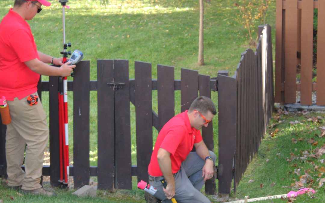
If you are getting ready to install a fence or add landscaping, you may be interested in knowing where your property lines are located so that you can ensure that you are staying on your own property. The professional who is most associated with property lines is a...
What Does Encroachment Mean in Real Estate?

What Does Encroachment Mean in Real Estate?

by Shelly C | Dec 22, 2022 | Encroachment, Surveying Related

By definition an encroachment is an intrusion on a person’s territory, rights, etc. In real estate we typically see the term encroachment used to describe items that are on the wrong property. Here are some common examples. Adjoining property fence located onto...
How can we determine property lines?

What to See on Your ALTA Survey Drawing

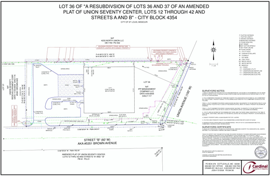
by Shelly C | Dec 22, 2022 | ALTA Survey, Surveying Related

There are 4 key elements that are required to be shown on a plat or map of an ALTA/NSPS land title survey drawing. This information can then be used by the client, lender, or title company to better understand the property and its improvements. The 4 elements are as...
« Older Entries
Next Entries »

Search

Recent Posts

  • Building in an Easement? Don’t Risk It!
  • “My Neighbor Said They Had a Survey” Why Boundary Surveys Matter
  • Built a New Home? Don’t Skip This Critical Survey Step
  • Boulder Overboard: When Assumptions About Property Lines Go Wrong
  • How to Order and Process Survey

Categories

  • ALTA Survey
  • Assessor
  • Benchmark
  • Boundary survey
  • Commercial
  • Common Ground
  • DIY
  • Drone
  • Easement
  • Elevation Certificate
  • Encroachment
  • Flood Zones
  • Land Surveying
  • National Society Of Professional Surveyors
  • NSPS
  • Property Lines
  • Radio & TV
  • Stake Survey
  • Surveying Related
  • Title Insurance
  • Topographic
  • Uncategorized

Cardinal Surveying & Mapping, Inc 

PO Box 278
Cottleville, MO 63338

ph: 636.922.1001

inbox@cardinalsurveying.com

Surveys

Boundary Surveying
Real Property Report
ALTA and ACSM Surveys

Our Site

About Us
Blog
FAQs

Opening hours

Mon – Fri – 8:00 – 05:00
Sat-Sun – Closed

Follow us

  • Follow
  • Follow
  • Follow
  • Follow
  • Follow

Copyright 2025| designed by The One Provider LLC