by Shelly C | Jun 14, 2018 | Flood Zones
An Elevation Certificate (EC) contains a wealth of information regarding a property and its risk of being flooded. The EC is performed by a Professional Land Surveyor or Engineer. This article further discusses the second half of the EC, please refer to the image...

by Shelly C | Oct 19, 2016 | Surveying Related
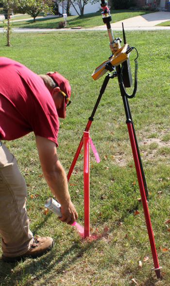
Have you ever done a puzzle? Where did you start – with the edge pieces or with the middle? If you’re like the majority of people, you always start with the edges. Surveying is similar in practice in that in order to know how the middle piece of the puzzle fits, you...
by Shelly C | Jun 21, 2016 | Surveying Related
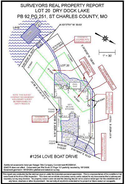
There are two main choices when considering having a survey performed. You can either get a boundary survey or you can get a Surveyors Real Property Report (SRPR). Let’s look at some of the Pros and Cons of the SRPR: Pros: Less expensive – SRPRs typically start around...
by Shelly C | Feb 26, 2013 | Uncategorized
What do land surveyors do? What’s the process? Our surveyors work in the office and the field. It is a job that is rooted deeply in mathematics, geo-location (fancy for GPS), and even measuring distances in the sky. Though the process is lengthy and has many...
by Shelly C | Feb 26, 2013 | Surveying Related
As defined by Black’s Law Dictionary an easement is an interest in land owned by another person, consisting in the right to use or control the land, or an area above or below it, for a specific limited purpose (such as to cross it for access to a public road). May...