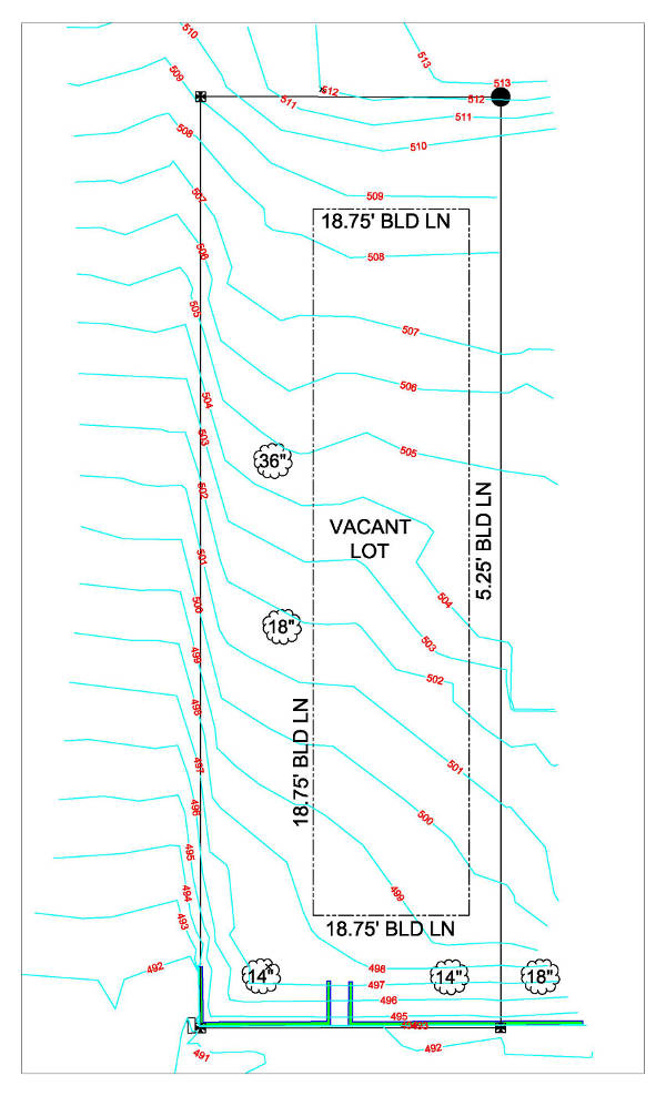
Surveying Related
Why Would I Get A Topographical Survey?

Why Would I Get A Topographical Survey?

A topographical survey shows a 3-D depiction of land on a 2-D product. There are many reasons as to why this information can assist a property owner. Here are a few of the main reasons: To build on. If you have a vacant piece of property, the topographic survey can...

read more
What Is A Topographic Survey?

What Is A Topographic Survey?

We live in a 3 dimensional world. Yet when a property survey is made, the results are shown via a 2 dimensional product - good ole paper and ink. A Topographical Survey is a 2-D representation of what is happening in the real world (3-D). The characteristics of a...

read more
What is a Boundary Survey?

What is a Boundary Survey?

The purpose of a boundary survey is to mark and identify where your property corners are located. Simply put, it shows you where your property begins and ends. When a boundary survey is completed by a professional land surveyor, a drawing is generated to show the...

read more

Know What You Own

Adverse Posession - Do you know what you own? The first step to take is to have a boundary survey (aka stake survey) performed on your property. By having a boundary performed, property corners will be clearly and visibly marked for all parties to see. If the neighbor...

read more

How do i find my own yard?

It seems like a simple question, but do you really know the answer? Where is your yard? What do you really own? Do you own everything inside your fence or everything outside of your neighbor’s fence? Do you own up to where you’ve always mowed, or, do you own up to...

read more

What is an Easement

As defined by Black’s Law Dictionary an easement is an interest in land owned by another person, consisting in the right to use or control the land, or an area above or below it, for a specific limited purpose (such as to cross it for access to a public road).  May...

read more