The words “common ground” always throws up a red flag to me. While common ground provides more “space” between you and your neighbors, it doesn’t mean that the land is for your private use and benefit. Common ground is typically deeded to subdivision associations and...
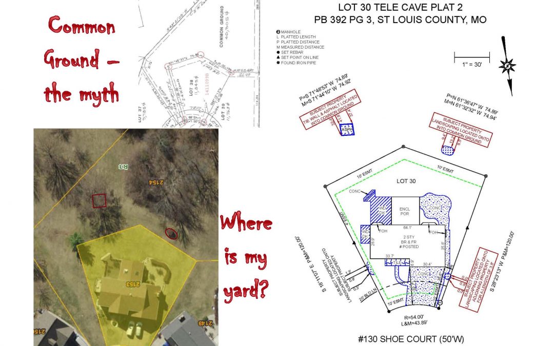
What Is A Lot Consolidation Plat?
A lot consolidation is requested by someone who wants to take multiple existing lots and combine them to create fewer “new” lots creating “consolidating” the lots. What type of property can be consolidated? A residential, commercial or industrial property may be...
Lot Split Plat
A lot split is requested by someone who wants to take an existing lot or lots and create two or more “new” lots, hence “splitting” the lot. What type of property can be split? A residential, commercial or industrial property may be split. This includes property that...
ALTA Surveys – Surveys on Steroids (Part II)
An ALTA Survey is basically a boundary survey on steroids. The minimum requirements for boundary surveys in the state of Missouri either meet or exceed the American Land Title Associations (ALTA) national requirements for surveys. However, ALTAs can be much more in...
ALTA Surveys – Surveys on Steroids (Part 1)
An ALTA Survey is basically a boundary survey on steroids. The minimum requirements for boundary surveys in the state of Missouri either meet or exceed the American Land Title Associations (ALTA) national requirements for surveys. However, ALTAs can be much more in...
Subdivision Plats – What Do They Tell Us?
Subdivision plats are the basis of almost all surveying, especially in urban areas where the legal descriptions are tied to a subdivision. When we survey “Lot 3 of Countryshire Estates”, the recorded plat of Countryshire Estates holds a majority of the information we...
How Much Does A Surveyors Real Property Report Cost?
The Surveyors Real Property Report (SRPR) and “spot” survey are one and the same. The term SRPR is the legal term to identify the report. The term “spot” is the layman’s term. There are many factors that can contribute to the cost of a SRPR. Some of the most common...
Topographic Surveys – What is a Contour Line
The data that a surveyor obtains when performing a topographic survey can be shown in a series of lines called contour lines. The proximity of these lines to one another is a direct correlation to the “peaks and valleys” that occur on the property. Here is some...
Topographic Surveys – Benchmark Elevations
A topographic survey typically shows contour lines of a property. Those contour lines have elevations assigned to them. The elevations are shown in relationship to the benchmark that has been established on the property and can be reported in one of two ways: Assigned...
Topographic Surveys – What is a Benchmark?
In order to create a contour map or a topographic map, the data and information obtained by the surveyor must be not only horizontally accurate, but also vertically accurate. A single point of reference, called a benchmark is used as a basis for the vertical data...