Get a free quote

636.922.1001

[email protected]

  • Surveys
    • Boundary Survey
    • Alta ACSM Surveys
    • Surveyor’s Real Property Report
    • Topographic Surveying
    • Plot Plans
  • Elevation Certificates
    • Flood Insurance and Elevation Certificates
    • FEMA / FIRM
  • Blog
    • Surveying Related
    • Flood Zones
    • Commercial
  • F.A.Q
  • About us
  • Videos
ALTA Survey Series Conclusion: Bringing It All Together.

ALTA Survey Series Conclusion: Bringing It All Together.

by Shelly C | May 8, 2025 | Uncategorized

The American Land Title Association (ALTA) and the National Society of Professional Surveyors (NSPS) have jointly developed standards for land title surveys, resulting in the ALTA/NSPS Land Title Survey. This survey goes far beyond simply marking property boundaries....
Google Maps vs. Reality: The Truth About Property Boundaries

Google Maps vs. Reality: The Truth About Property Boundaries

by Shelly C | Mar 1, 2025 | Uncategorized

It is hard to not trust the information that we get from the Internet. You should be cautious when using Google or the county assessor to look at aerial photos of your property. These sites will show you your home within a few inches. There are times when this is...
Questions Answered! How Can We Determine Property Lines?

Questions Answered! How Can We Determine Property Lines?

by Shelly C | Nov 1, 2024 | Land Surveying, Property Lines

Property lines can be determined by having a boundary survey performed on your property. While it may be tempting to rely on aerial photography with calculated lines drawn onto them, that information is not accurate and per state statute should not be relied upon for...
What Is An Offset And Why Didn’t You Mark The Corner Of The Property?

What Is An Offset And Why Didn’t You Mark The Corner Of The Property?

by Shelly C | Jun 1, 2024 | Boundary survey

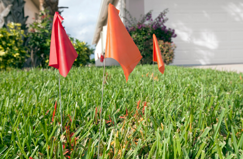
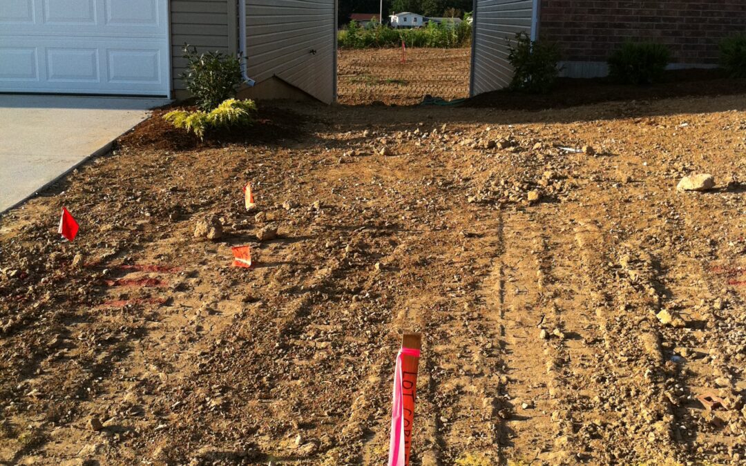
The whole purpose of having a boundary survey performed is to have your property corners located marked verified and set if they are missing. From time to time there are instances where a surveyor is not able to set a monument at the actual corner and are forced to...
How Is There An Easement Running Through My Building?

How Is There An Easement Running Through My Building?

by Shelly C | Dec 28, 2023 | Boundary survey, Easement, Land Surveying

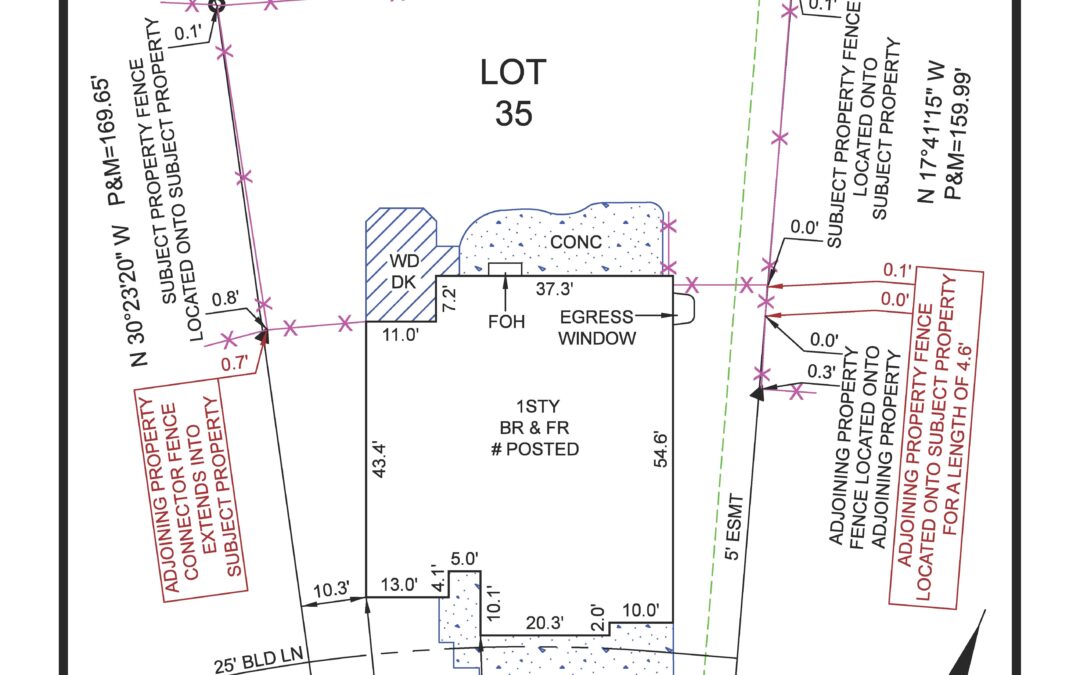
You did the right thing by getting a boundary survey and yet it seems to have done nothing but create a headache for you as the survey drawing is showing an easement running right through the middle of the metal building on the property. How in the world did this...
« Older Entries

Search

Recent Posts

  • ALTA Survey Series Conclusion: Bringing It All Together.
  • The Utility Box Is Lying to You (About Your Property Line)
  • More Than Just Property Lines: The Value of a Detailed Boundary Survey.
  • The Final Item on Table A: Why the Blank Line Matters
  • Google Maps vs. Reality: The Truth About Property Boundaries

Categories

  • ALTA Survey
  • Assessor
  • Benchmark
  • Boundary survey
  • Commercial
  • Common Ground
  • Drone
  • e-commerce
  • Easement
  • Elevation Certificate
  • Encroachment
  • Flood Zones
  • Land Surveying
  • Marketing
  • National Society Of Professional Surveyors
  • NSPS
  • Property Lines
  • Radio & TV
  • Sales
  • Stake Survey
  • Surveying Related
  • Title Insurance
  • Topographic
  • Uncategorized

Cardinal Surveying & Mapping, Inc 

PO Box 278
Cottleville, MO 63338

ph: 636.922.1001
fx: 636.922.1002

[email protected]

Surveys

Boundary Surveying
Real Property Report
ALTA and ACSM Surveys

Our Site

About Us
Blog
FAQs

Opening hours

Mon – Fri – 8:00 – 05:00
Sat-Sun – Closed

Follow us

  • Follow
  • Follow
  • Follow
  • Follow
  • Follow

Copyright 2024| designed by The One Provider LLC