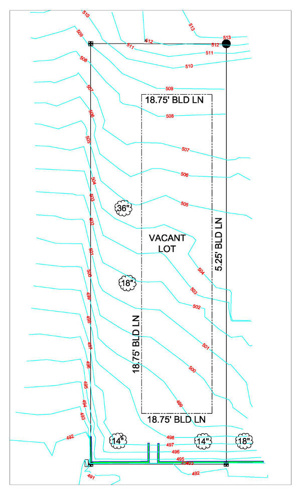
We live in a 3 dimensional world. Yet when a property survey is made, the results are shown via a 2 dimensional product – good ole paper and ink. A Topographical Survey is a 2-D representation of what is happening in the real world (3-D). The characteristics of...
Also known as a “topo” or “survey with contours.” Who Uses Topographic Surveys: Engineers, Architects and Landscape Architects Grading companies Municipalities FEMA We perform Topographic Surveys on the following types of properties: ...